Climex and Dymex Suite 4.0.2
Climex
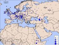
CLIMEX helps you understand the impact of climate change on species distribution and the potential risk from invasive species to an agricultural region.
CLIMEX enables you to assess the risk of a pest establishing in a new location and the potential success or failure of a biological control agent with no knowledge of the species, except for knowing the current locations they do occur.
In almost forty countries around the world, Climex is used to model, predict and help control invasive insects. Insect infestation destroys billions of dollars’ worth of commercial crops annually and monitoring and controlling invasive insects in a warming world is increasingly important.
Dymex
DYMEX enables you to interactively build and run models of fluctuating populations of organisms in changing environments. Ecologists can create a wide range of process-based population models without the need to know a programming language. Models are structured around lifecycles, which in turn consist of the stages that individuals pass through during their life. A DYMEX lifecycle describes cohorts of individuals and the processes that affect the size, age and number of individuals in the cohort.
What’s new in the latest version of Climex and Dymex (version 4.0.2)
-
Version 4 of CLIMEX runs approximately 10 times faster than version 3.
-
Improved automatic parameter-fitting
-
The Compare Locations model can now create weekly output maps for the stress and growth indices.
-
A new model has been added, the CLIMEX Compare Locations/Years, which allows inter-annual variation in climate suitability to be explored.
-
You can now make movies of seasonal and inter-annual patterns of climate suitability.
-
Automated parameter sensitivity and model uncertainty analyses are available.
-
The regional climate matching function can now handle much larger datasets.
-
Batch parameter runs can now be sequenced, automating some highly repetitive tasks.
-
CLIMEX can now be installed on computers running the 64-bit version of Windows.
-
The new User Guide includes a section on modelling tips and resources.
-
Improvements to Output Streaming, sensitivity analysis, Match Climates (Regional), Compare Locations
The User Guide for CLIMEX is now bundled with the installation.